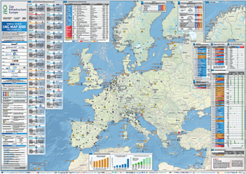
The GIE large-scale LNG Map provides comprehensive information on existing, under-construction and planned large-scale LNG import terminals across Europe.
It includes key data, such as send-out capacity, annual capacity, LNG storage capacity, and other main facility characteristics.
Updated every two years with firsthand information from GLE members, the large-scale LNG Map is a reliable source for key stakeholders.
The map and its associated database also build on the work carried out by ENTSOG in the context of the Ten-Year Network Development Plan (TYNDP) and the Winter and Summer Supply Outlooks, as well as on the transparency initiatives ALSI and AGSI, developed by Gas LNG Europe (GLE) and Gas Storage Europe (GSE).
Together, these resources help enhance transparency in the energy market.
Digital version only at the moment, printed maps available soon.
| Version | August 2026 |
|---|---|
| Version | Digital only |
| Updates | Annual |
| Format | A0 |
| Dimensions | 1189 x 841mm |
| Process | Quadri color offset print |
| Paper options | 250g glossy paper with glossy lamination on one side |
| Finishing options | Plano (rolled) |
| Packaging | Delivered in cardboard box |